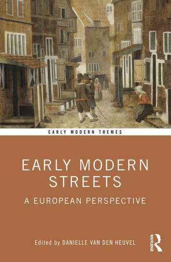
New Book on Amsterdam Street Life

On October 6, Bob Pierik’s book on the life in Amsterdam’s streets will see the light. Based on his PhD dissertation, the book recounts the everyday experiences of Amsterdammers in the 17th and 18th centuries. Full of wonderful stories, the book lets you time travel to the streets of early modern Amsterdam, and experience the forgotten sounds and smells, and meet all those who occupied the streets of this lively city.

The book is for a Dutch readership and published by Meulenhoff.

https://www.meulenhoff.nl/producten/zo-veel-leven-voor-de-deur-9789029098281

From the publisher’s website:

Een bruisende geschiedenis van het Amsterdamse straatleven in de zeventiende en achttiende eeuw. Na alle boeken over belangrijke bestuurders krijgen nu eindelijk ook de gewone Amsterdammers uit die tijd een gezicht.Het Amsterdamse centrum staat vol monumenten. Maar al die stenen herinneringen aan een rijk verleden zeggen weinig over hoe de zeventiende- en achttiende-eeuwse Amsterdammers de openbare ruimte gebruikten. Wie kwam je tegen in de straten van het oude Amsterdam? Wat zag je, hoorde je en maakte je mee als je je door de stadspoorten naar binnen begaf ?

New Book on Early Modern Streets.

For the first time, Early Modern Streets unites the diverse strands of scholarship on urban streets between circa 1450 and 1800 and tackles key questions on how early modern urban society was shaped and how this changed over time. The volume brings together scholars from different backgrounds and applies new approaches and methodologies to the historical study of urban experience. In doing so, Early Modern Streets provides a comprehensive overview of one of the most dynamic fields of scholarship in early modern history.

This new text book on street life is published in the Early Modern Themes series by Routledge and includes a chapter by Danielle on the past, present and future of the field.

Staying in One's Own Lane: A Pattern of Residential Marriage Mobility

By Judith Kraamwinkel

On 6 September 1737, Stijntje Koops married Hellebartus van der Schemp, both of whom were living on Kattenburg at the time.[1] Stijntje married five times in total throughout her life, and every time her groom lived in the same street as she did. Although few women married as often as Stijntje, many married men who lived nearby. The frequency with which marriage partners lived close to each other or even in the same street led me to question the influence space had on early modern partner selection. I have thus studied where marriage partners lived in relation to each other in eighteenth-century Amsterdam, which I have named the residential marriage pattern.

The marriage bann of Stijntje Koops and Hellebartus van der Schemp, Stadsarchief Amsterdam, Ondertrouw 5001: 580, 70

My research addresses two gaps in the historiography on early modern city life. First, most studies on migration in this period focus on migration between cities, not within the city.[2] This is mostly due to a lack of source material for the latter. I found that the marriage banns, announcements of the intention to marry, were the most reliable source to find people’s addresses at different points in their lives, as I will expand on below. Secondly, there has been a lack of historical research into the spatial dimension of partner selection in the early modern period. Jan Kok and Marco H.D. van Leeuwen consider this topic for the nineteenth and twentieth centuries in their book Genegenheid en Gelegenheid (2005), but my research seems to be the first exploration of this topic for the early modern era.

The vast majority of my data comes from the marriage banns. These documents are a very consistent source of address, as they almost always record the addresses of both the bride and groom. This meant that, for the people who married more than one, I could calculate the distances between the residences of them and their partners at several points in life. I decided to plot the distance based on potential walking routes, not as the crow flies. Partner selection would have been influenced by how far people experienced the distance to be, not how far it actually was. Especially in a city like Amsterdam, where the presence of canals and the placement of bridges influence walking routes, this experienced distance may be further than the actual one. A closer look at the data also caused me to create three different groups, based on religion: one that included women regardless of their religion, henceforth called the general group, a Jewish group, and a Lutheran group. I will discuss this more in-depth below, but my goal was to examine to what extent religious minorities in early modern Amsterdam displayed the same residential marriage pattern as the general population, especially due to the presence of the Jewish Quarter.

As the table shows, in general, marriage partners in eighteenth-century Amsterdam lived, on average, less than 700 metres away from each other. In this period, Amsterdam was around 2.5 kilometres from north to south and 3.8 kilometres from east to west as the crow flies, and this distance is thus rather small in comparison to the city’s size. A third of brides and grooms lived in the same street as each other. In this case, the sources register the bride’s address as als voorn (as before), indicating she lives in the same place as the groom, who is recorded first. These small distances can be put into a broader historical context by examining the development of the distance between the residences of marriage partners. Kok and Van Leeuwen argue that the modernising period saw a broadening of the geographic marriage horizon. They argue the radius in which people married increased in the nineteenth century, coming to a halt in the first half of the twentieth century.[3] These long-lasting relationships over larger distances were enabled by improving transport and communication technology.[4] My research shows that, just before this rapid modernisation process, the geographic marriage radius was rather small, at least within a major city like Amsterdam. Potential future research could explore whether the marriage radius also changed over the course of the early modern period, and how the distances in the countryside compare to those in the city.

View of the Portuguese Synagogue in Amsterdam, engraving by Jan Schouten and Pierre Fouquet, 1770s, Stadsarchief Amsterdam

I decided to examine to what extent religious minorities displayed a similar residential marriage pattern as the general group, as I thought the Jewish population would have a smaller average distance due to the presence of the Jewish Quarter, in the east of the city. Although Amsterdam authorities technically allowed Jewish people to live anywhere in the city, they still congregated in this area.[5] This is mostly attributed to the presence of a synagogue, the wish for a nearby religious community, and the fact that the Jewish elite had a large amount of self-rule within the Jewish Quarter.[6] As the table shows, the Jewish average distance was indeed much lower than that of the general group, and Jewish marriage partners only lived 459 metres apart. Moreover, the addresses I found were all within the Jewish Quarter, save for those Jewish people who lived on the canals. Since most marriage banns only record street names, not exact locations, it is difficult to establish where these people lived on the canals, but it plausible they would inhabit the part of the canals closest to the Jewish Quarter, since the rest of the Jewish population so consistently inhabited that area. Thus, in the case of Amsterdam’s Jewish residents, we can find a clear reason for their comparatively small average marriage distance: the presence of the Jewish Quarter.

I examined the residential marriage pattern of another religious minority, the Lutherans, to establish whether the small Jewish distance was a characteristic of religious minorities in general or of the Jewish population, specifically. The Lutheran population did not have a Lutheran quarter, and they were spread out over the city in a similar way as the general population. Jessica den Oudsten notes that first-generation Lutheran immigrants from Scandinavia often lived in the Oostelijke Eilanden, which was home to a Norwegian-Danish community, but that their descendants spread out across the city, which suggests that the Lutheran population did not have a shared community based on place of residence.[7] This is thus a very different situation than the one that characterised the Jewish community of Amsterdam described above. Lutheran marriage partners lived, on average, 633 metres away from each other, which resembles the general pattern much more than the Jewish one. The Jewish Quarter thus caused the Jewish population’s unique residential marriage pattern. Future research could examine whether there were other geographically concentrated groups that display similar residential marriage patterns to the Jewish population.

Round Lutheran Church, Singel 11, engraving by Jacobus Verheyden, 1723, Stadsarchief Amsterdam

One way to analyse my results is by connecting them to earlier research into general mobility. Bob Pierik’s research into daily mobility in eighteenth-century Amsterdam shows that no group ventured, on average, more than 700 metres away from home at any point in the day.[8] The correspondence between this number and the residential marriage patterns suggests that the two are connected. This is unsurprising to some extent, as one cannot marry people one does not meet, and one does not meet people outside of one’s radius of operation. The exact link between the two, however, still needs to be determined. A combined analysis of these two studies could also help analyse the system of neighbourhoods in early modern Amsterdam. Pierik notes that it is difficult to study these, as a lack of formal organisation means Amsterdam does not have any neighbourhood archives for historians to use.[9] The fact that both daily mobility and the residential marriage pattern have a distance of 700 metres suggest eighteenth-century people tended to have similar limits to their radius of operation, but future research is necessary to determine exactly how this worked: was one’s neighbourhood defined by specific geographic regions, and thus shared between people, or by a certain area around one’s house, meaning they were unique to every person?

A notable feature of the data in this research is the lack of mobility between the east and west of Amsterdam. Only 13% of women in the general and 10% in the Lutheran group made the east-west crossing at some point in their lives. None of the Jewish women did, which can be attributed to the fact that the Jewish Quarter was located in the east of the city. This lack of mobility between the two parts of Amsterdam can be explained by examining the city’s infrastructure, and especially the low accessibility of the canal district, which spans the city. Clé Lesger explains that, in the seventeenth century, the elite built the canal district to be a quiet residential area, and they thus designed it to ensure little traffic flow.[10] His research shows that the only highly accessible crossing point between East and West Amsterdam was the Dam, as the canal network was time-consuming and difficult to cross.[11] This may have led to low daily mobility between these parts of the city and would thus have influenced the marriage market, as people from the east and west would have been less likely to meet and thus marry. Further research is necessary to fully understand the influence of the city’s infrastructure on the marriage market and other aspects of early modern daily life, but the apparent division between the two sides of the city could form an interesting starting point.

The primary conclusion to be drawn from this research is that the influence of space on the marriage market is a topic that historians need to give more attention to. The relatively small distances between the residences of marriage partners in the different groups suggest that space did, in fact, exercise some control over the selection of a marriage partner, and studying early modern marriage through a spatial lens may be helpful in better understanding this aspect of daily life. This observation can also be used in the study of neighbourhoods and community in eighteenth-century Amsterdam as it suggests people’s networks were close to home. As I mentioned throughout this piece, the different parts of my research lead to many different questions relating to partner selection, mobility, neighbourhoods, and the influence of infrastructure on daily life. My initial exploration of this topic is thus not meant to be taken as the final conclusion of it, but as a springboard for future research.


[1] Het Stadsarchief van Amsterdam (Amsterdam City Archives), Ondertrouwregister, 5001:580, 70, 6 September 1737.

[2] Danielle van den Heuvel and Julia Noordegraaf, Unpacking Urban Life in the Past: Time Machine as a Data Visualisation and Analysis Tool for Researching Everyday Urban Experience across Space and Time, forthcoming, 26.

[3] Jan Kok and Marco H.D. van Leeuwen, “Genegenheid, Gelegenheid en Dwang: Twee Eeuwen Partnerkeuze en Huwelijk in Nederland en Vlaanderen”, in Genegenheid en Gelegenheid: Twee Eeuwen Partnerkeuze en Huwelijk, ed. by Jan Kok and Marco H.D. van Leeuwen (Amsterdam: Aksant, 2005), 1 – 28, 7.

[4] Ibid, 7.

[5] Clé Lesger and Marco H.D. van Leeuwen, ‘Residential Segregation from the Sixteenth to the Nineteenth Century: Evidence from the Netherlands’, Journal of Interdisciplinary History 42 (2012), 333-369, 365.

[6] Ibid, 365.

[7] Jessica den Oudsten, The Descendants of Norwegian and Danish Immigrants: Integration, Assimilation, and Social Mobility in Amsterdam, 1660-1811, unpublished MA thesis, 2021, 54.

[8] Bob Pierik, “From Microhistory to Patterns of Urban Mobility: The Rhythm of Gendered Mobility in Eighteenth-Century Amsterdam”, in Daily Lives and Daily Routines in the Long Eighteenth Century, ed. by Gudrun Andersson and Jon Stobart (New York, N.Y.: Routledge, 2022), 105 – 124, 110.

[9] Ibid, 115.

[10] Clé Lesger, Shopping Spaces and the Urban Landscape in Early Modern Amsterdam, 1550 – 1850 (Amsterdam: Amsterdam University Press, 2020), 93.

[11] Ibid, 94.

New articles on gender, vehicles and privacy

Two new articles by Bob are out now!  

In the first of these, “Coaches, Sleighs, and Speed in the Street: “Vehicularization” in Early Modern Amsterdam,” in the Journal of Urban History, you can read about the introduction and presence of vehicles in early modern Amsterdam. This emerging ‘culture of wheels’ is also analyzed from a gender perspective.  

In the second, “Privacy, Publicity and Gender in Amsterdam’s Early Modern Urban Space,” in the newly launched Privacy Studies Journal, you can read about practices of everyday gatekeeping: the way in which people navigated privacy and publicity in the streets and in their houses.  

New article: Settan's Original Sketches of early modern Edo

The article "Capturing the Urban Spaces of Edo:  Hasegawa Settan's Original Sketches for the Edo Meisho Zue in the Sankô Library" by Marie Yasunaga appeared in the latest Ukiyo-e Art (International Ukiyo-e Society, no. 184, July 2022, pp. 5-26). 

It introduces her significant discovery of the two handscrolls of the preparatory sketches by the painter Hasegawa Settan for his well-known book illustrations of the Edo Meisho Zue or the Illustrated Guidebook of Famous Places in Edo (1834 and 1836), revealing how the artists' observational eyes captured the reality of the urban life in the early modern capital of Japan.